KADIS HMI SW Development
WKKim
08/23/2024
CSharp
Winform
Overview
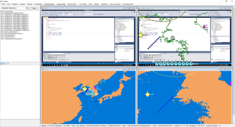
- Developed military software that overlays symbols on video and maps to convey situational awareness to users in aircraft.
Key Tasks
- Display live video received via UDP and overlay maps and symbols on the video signal.
- Extract coordinates (latitude and longitude) based on mouse position.
- Created transparent forms to overlay maps and symbols when direct overlay on video data was not possible.
- Implemented methods to calculate actual latitude and longitude based on screen scale and map ratio.
Challenges & Solutions
- Realized the need for creative solutions, like using transparent forms when direct data insertion was not possible.
- Solved mathematical problems, such as calculating real-world coordinates from mouse positions.
Lessons Learned
- Creativity is often required in software development.
- Mathematical approaches can simplify complex problems.
Symbol Implementation
- Implemented various symbols and adaptive symbols that change shape and size based on user input coordinates, complying with US DoD standard MIL-STD-2525D and additional customer symbols.
Challenges & Solutions
- Classified symbols with similar properties and essential attributes using interfaces and parent classes, leveraging inheritance.
- Found and implemented the Bezier curve algorithm for drawing curved symbols based on user input coordinates.
Lessons Learned
- Inheritance helps reduce development volume and makes maintenance easier.
- Many problems can be solved by researching similar cases and algorithms.